Introduction to Celestial Navigation: Finding Your Way by the Stars in a Digital Age
Beyond the Blue Dot: Rediscovering the Sailor’s Ancient Art
The Allure of Self-Reliance in an Automated World
In our modern world, we’ve grown accustomed to knowing our precise location at a glance. A bright blue dot on a digital screen tells us, “You are here.” It is a marvel of technology, offering unparalleled convenience and safety. Yet, this reliance is a passive one. We receive information without participation, outsourcing our awareness to satellites and silicon. Celestial navigation offers the complete antithesis. It is an act of profound engagement, a dialogue with the universe. It demands that you slow down, observe, and think. It transforms the sailor from a mere passenger following a digital line into an active participant in the grand, celestial mechanics of the cosmos. This practice is a form of mindfulness, a way of cultivating a deep, almost primal, connection to the sea and the sky, grounding you in your environment in a way a screen never can.
A Living Connection to Maritime History
To pick up a sextant is to hold history in your hands. It is to join an unbroken chain of seafarers who looked to the same sun, moon, and stars to find their way across vast, unknown oceans. When you measure the angle of the sun, you are repeating the same fundamental act performed by legends like Captain James Cook as he charted the Pacific with unprecedented accuracy. You are sharing a kinship with Joshua Slocum, who trusted his skill and a simple clock on his solo circumnavigation. You are employing the very principles that enabled Sir Ernest Shackleton to navigate a small, open boat across 800 miles of the world’s most treacherous seas to save his crew. The technology has been refined, but the cosmic truths remain unchanged. You are not just learning a backup technique; you are becoming a practitioner of a timeless and noble art.
The Magic of Turning Starlight into a Position
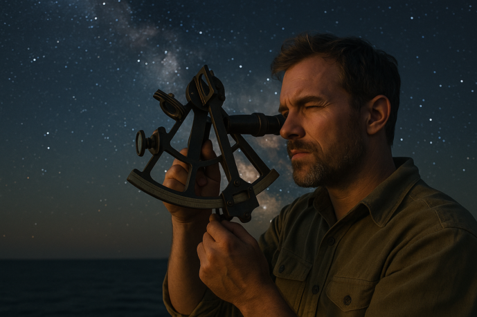
There is a moment in celestial navigation that borders on the sublime. It often comes in the quiet of a dawn or dusk watch, on a gently rolling deck far from land. You raise the sextant, a beautiful instrument of brass and glass, and carefully “bring down” a star or the sun’s lower limb to kiss the horizon. You note the precise second from your chronometer. Then, with a pencil, a nautical almanac, and a set of tables, you begin a quiet, methodical ritual. You are not performing complex mathematics but following a prescribed path of discovery. And then, the magic happens. These abstract elements—an angle from the heavens, a moment in time, and figures from a book—converge. On your paper chart, you draw a simple line. You have taken the faint, ancient light from a star millions of miles away and transformed it into a tangible, meaningful answer to the most fundamental question a sailor can ask: “Where am I?” It is a profound and deeply satisfying feeling, a quiet miracle you perform yourself.
The Cosmic Clockwork: How Celestial Navigation Works
At first glance, celestial navigation can seem like an arcane blend of mathematics and magic. In reality, it’s built on a beautifully simple and elegant foundation: the predictable, clockwork motion of the heavens. Once you grasp the core idea, the mystery begins to dissolve, replaced by a profound appreciation for cosmic geometry.
The Core Concept: The Sky as a Perfect, Predictable Map
The fundamental principle is this: at any given instant, every celestial body—the sun, the moon, a planet, or a star—is directly above one specific point on the Earth’s surface. This point is called its Geographic Position (GP). Think of the sun as a colossal, cosmic lighthouse. As the Earth spins, the beam of this lighthouse sweeps across the globe, and its GP traces a precise, predictable path.
The sky, therefore, is not a random scattering of lights but a perfect map. If you can identify a star and know the exact time, you can look up its GP in a book. The entire art of celestial navigation boils down to figuring out your relationship to that known point on the globe.
Your Tools: A Sextant, a Clock, and a Codebook
To solve this cosmic puzzle, the navigator needs only three essential things. This isn’t a high-tech arsenal; it’s a classic toolkit that has been refined over centuries. At a high level, they are:
- A Sextant: An instrument for measuring the angle between the horizon and a celestial body.
- A Chronometer: An extremely accurate clock that tells you the precise time at the prime meridian (UTC or GMT).
- The Codebooks: A Nautical Almanac to find a star’s GP for a given time, and Sight Reduction Tables to do the math for you.
That’s it. One tool to measure an angle, one to know the time, and a set of books to translate that information into a position on a chart. The complexity lies in the details, but the concept is that straightforward.
Measuring an Angle, Finding a Circle
When you use your sextant to measure the angle (called “altitude”) of a star above the horizon, you are accomplishing something remarkable: you are determining your exact distance from that star’s Geographic Position (GP). There is a direct mathematical relationship between the angle you see and your distance from the spot on Earth directly beneath the star.
This single measurement, however, doesn’t give you a precise location. Instead, it tells you that you are located somewhere on a massive circle on the Earth’s surface, with the star’s GP at its center. Every single navigator standing anywhere on the edge of this Circle of Position would measure the exact same angle to that star at the exact same moment. You’ve narrowed your position from “somewhere on the ocean” to “somewhere on this specific circle.”
From a Circle to a Line of Position (LOP)
Drawing a circle thousands of miles in diameter on your nautical chart is, of course, impossible and impractical. Fortunately, you don’t have to. Because the Circle of Position is so enormous, the small portion of it that you are actually on is, for all intents and purposes, a straight line. Think of the curvature of the Earth itself—over a short distance, it feels perfectly flat.
So, instead of a giant circle, the navigator plots a short, straight line on the chart. This is your Line of Position (LOP). The calculation tells you where to draw this line and how to orient it. You now know with certainty that your boat is located somewhere along that one, single line. You have successfully turned a twinkle of starlight into a meaningful line on a map.
The Navigator’s Essential Toolkit
While the theory of celestial navigation is beautifully simple, its practice relies on a few key pieces of equipment. These are not black boxes; they are elegant instruments of science, each with a specific and vital role. Together, they form a self-contained system that can pinpoint your location in the middle of the vast ocean.
The Sextant: Capturing the Sun
More than a mere tool, the sextant is a symbol of the navigator’s art. It is a beautiful instrument of brass and steel, mirrors and lenses, engineered with astonishing precision. To hold one is to feel a connection to centuries of maritime exploration. Its sole function is to do one thing perfectly: to measure the angle between the horizon and any celestial body. By using a clever system of mirrors, you can look at the horizon and the sun (or a star) at the same time, “bringing the sun down to the horizon” and reading the resulting angle, called the altitude, off a finely marked arc. This single, precise measurement is the foundational piece of data for all of celestial navigation.
The Chronometer: The Heartbeat of Your Position
If the sextant is the eye of the navigator, the chronometer is the heart. No piece of equipment is more critical than an accurate timepiece. Every calculation in celestial navigation depends on knowing the exact time at the Prime Meridian in Greenwich, England—known as Greenwich Mean Time (GMT) or, more modernly, Coordinated Universal Time (UTC). But why is time so vital? Because the Earth rotates at a steady, known rate of 15 degrees per hour. Time, therefore, is directly translatable into longitude. An error of just a few seconds in your time can place you miles away from your true position. A reliable chronometer, carefully protected and checked, is the indispensable link between the clockwork of the heavens and your position on the chart.
The Nautical Almanac: The Celestial Timetable
Imagine a “TV Guide” for the heavens, and you have the Nautical Almanac. This thick book, published annually, is the navigator’s essential reference. It contains page after page of tables that predict the exact position of the sun, moon, planets, and 57 key navigational stars for every single moment of the year. For any given second of UTC, the almanac will tell you the celestial body’s “Geographic Position” (GP)—the precise point on the Earth’s surface where it is directly overhead. This book transforms the dynamic, moving sky into a predictable and usable set of data, allowing you to know exactly where your chosen “cosmic lighthouse” is at the moment you take a sight with your sextant.
Sight Reduction Tables and a Pencil: Decoding the Sky
Here is where the intimidating mathematics of celestial navigation is made manageable. While you could solve for your position using complex spherical trigonometry, generations of navigators have relied on a much simpler method: Sight Reduction Tables. These tables, such as the famous Pub. No. 229, are essentially pre-calculated solutions to the navigational triangle. They are a brilliant shortcut. By entering the tables with your approximate latitude and the information about the celestial body from the Nautical Almanac, the tables provide you with what the body’s altitude and bearing (azimuth) *should* be from your assumed location. By comparing this calculated altitude with the true altitude you measured with your sextant, you can quickly determine how far you are from your assumed position and plot your Line of Position. These tables, combined with a sharp pencil and a clear mind, turn a complex problem into a straightforward, repeatable process.
From Sun Shot to Fix: A Simplified Walkthrough
The theory is one thing, but the practice is where the magic truly lives. The process of turning a glint of sunlight into a definitive position on a chart is a ritual, a sequence of steps honed over centuries. While it demands precision, it is not an arcane mystery. It is a repeatable, deeply satisfying procedure. Here is a simplified look at how a navigator coaxes their location from the sky.
Step 1: Taking the Sight
This is the most iconic moment in celestial navigation. Standing on the deck, you raise the sextant to your eye. Through its mirrors, you find the sun, a brilliant disc in the sky. The task is to “bring the sun down to the horizon.” By carefully adjusting the instrument’s index arm, you move the reflected image of the sun downwards until its lower edge, its “lower limb,” appears to just kiss the distant, sharp line of the sea. It’s a delicate dance between your hand, the ship’s motion, and the cosmos. At the precise moment of contact, you glance at your chronometer and record the exact time and the angle shown on the sextant’s arc. The classic and most straightforward sight is taken at midday, when the sun reaches its highest point in the sky for the day—an event known as Local Apparent Noon.
Step 2: The “Noon Sight” to Find Latitude
There is a unique elegance to the noon sight, a method so fundamental it feels like a secret whispered from the past. For centuries, finding latitude was the mariner’s most reliable tool. At its zenith, the sun’s altitude relates directly to your north-south position on the globe. With a few simple corrections and a lookup in the Nautical Almanac to find the sun’s declination (its latitude above the equator on that day), your measured angle transforms into your boat’s latitude. It’s a moment of pure clarity; the sun’s peak arc has told you exactly how far you are from the equator, with a minimum of fuss and calculation.
Step 3: Reducing the Sight
A raw sextant reading is not yet ready for the chart. It must be “reduced” or “cleared” through a series of corrections—a process that is less about complex mathematics and more like following a well-defined recipe. You begin by adjusting for known errors. First is “dip,” a correction for your height of eye above sea level; the higher you are, the farther the horizon appears. Next, you correct for atmospheric refraction, the slight bending of light as it enters our atmosphere. These are simple additions and subtractions found in tables at the front of the Nautical Almanac. With your corrected altitude, you dive into the main body of the Almanac and the Sight Reduction Tables. These books are your codebreakers, doing all the heavy spherical trigonometry for you. You enter with your time, your assumed position, and the celestial body you observed, and the tables give you back the data needed to plot.
Step 4: Plotting Your Line of Position
The result of your sight reduction is not a single point, but a line: the Line of Position (LOP). By comparing your sextant’s corrected altitude with the altitude the tables calculated for your assumed position, you discover a small difference. This tells you whether to move your line toward or away from the sun’s position on the globe. Using a protractor and parallel rulers, you draw this straight line on your nautical chart. The meaning of this line is profound: you are not at your assumed position, but you are, with certainty, located somewhere along this specific line on the surface of the ocean.
Step 5: The “Fix” – Where You Are
A single LOP is a huge leap forward, but it doesn’t tell you exactly where you are. To find your actual position, you need a “fix.” A fix is the point where two or more Lines of Position intersect. To get a second LOP, you can take a sight of another body—the moon, or a bright planet or star. More commonly, you wait an hour or two and take a second sight of the sun. Because the Earth has rotated, the sun is in a new position, and this second sight will yield a new LOP that crosses the first one at an angle. The point where they cross, with a small adjustment made for your vessel’s movement between sights, is your position on the chart. This is the moment of triumph: you can draw a small circle or triangle around that intersection and say with confidence, “This is where we are.”
Why Bother in a Digital Age? The Enduring Value of the Stars
The Ultimate Failsafe: When the Satellites Go Silent
In a world of constant connectivity, it’s easy to view the blue dot on our screens as infallible. Yet, this reliance is fragile. The Global Positioning System, for all its modern marvel, is vulnerable. A vessel’s electrical system can fail, cutting power to the chartplotter. A powerful solar flare can disrupt satellite communications. Military or state-level signal jamming can render GPS useless in certain regions. In these moments, when the digital world vanishes, the celestial navigator remains empowered. Celestial navigation is the ultimate analog backup, a self-contained system that depends on nothing more than the sky, a clock, a sextant, and human knowledge. It is the final guarantee of finding your way home.
Sharpening the Mind: A Sailor’s Sudoku
Beyond its practical utility, celestial navigation is a profound mental exercise. It is a puzzle of geometry, time, and observation that demands focus and precision. Following the steps—from taking a sight to reducing it with tables and plotting a line—is a rewarding process that engages the brain in a way that passively following a magenta line on a screen never can. It keeps a sailor’s mind sharp, analytical, and attentive. Each successful fix is a small victory, a confirmation of one’s ability to solve a complex problem using intellect and skill, making it a deeply satisfying mental workout for any mariner.
A Deeper Connection to the Natural World
To navigate by the stars is to see the world differently. It requires you to develop an intimate relationship with the environment around you. You become acutely aware of the sun’s arc across the sky, the subtle phases of the moon, and the steady march of the constellations. The rhythm of the cosmos becomes your rhythm. You are no longer just a passenger on the ocean, insulated by technology; you are an active participant, reading the signs of the natural world to understand your place within it. This practice fosters a level of environmental awareness and connection that is both humbling and deeply enriching.
Earning Your Salt: The Mark of a “True” Sailor
In the close-knit world of offshore sailing, certain skills command a unique and quiet respect. Celestial navigation is chief among them. It is more than a backup plan; it is a badge of honor, a sign that you have earned your place in a long and storied tradition. To be able to find your position with a sextant is to demonstrate a level of competence, patience, and self-reliance that speaks volumes. It connects you directly to the legacy of the great navigators and proves you possess the foundational knowledge of a master mariner. It is, for many, the skill that separates the casual boater from the sailor who has truly earned their salt.
How to Begin Your Celestial Journey
The path from curious observer to competent navigator is a rewarding one, built step by step. You don’t need to be on a rolling deck in the middle of the ocean to start. The journey begins with simple, deliberate actions you can take today, connecting you with the sky and the timeless knowledge of the mariners who came before.
Start on Land: Learn the Constellations
Before you ever touch a sextant, your most important tool is your own sense of wonder. Your celestial journey begins in your own backyard. On a clear night, step outside and simply look up. The first, most fundamental skill is to become familiar with the celestial landscape. Learn to identify the major constellations that wheel across the sky in your hemisphere. Find Polaris, the North Star, or the Southern Cross. Trace the path of Orion and learn to spot the Big Dipper. This isn’t just stargazing; it’s learning the landmarks on the cosmic map you will one day use to find your way. This simple act of observation builds an intuitive foundation for everything that follows.
Read the Masters: Essential Books for the Aspiring Navigator
Celestial navigation is a craft passed down through generations, and much of that wisdom is captured in brilliant, accessible books. While the theory can seem complex, great teachers have a way of making it clear and manageable. Arming yourself with a good text is like having a seasoned mentor on your bookshelf. Consider starting with these classics:
- Celestial Navigation for Yachtsmen by Mary Blewitt: This slim volume is a masterclass in clarity and concision. For decades, it has been the go-to primer for sailors wanting to grasp the core concepts without being overwhelmed. It proves that the essentials can be taught elegantly and simply.
- The Celestial Navigation Trilogy by David Burch: For those seeking a modern, comprehensive approach, David Burch’s work is unparalleled. His books break down the process into digestible parts, blending traditional methods with modern understanding, making them an invaluable resource for the serious student.
Digital Tools for an Analog Skill
It may seem counterintuitive, but your smartphone or computer can be an excellent training partner for learning this ancient art. A variety of apps and software programs can simulate a sextant, allowing you to practice “taking a sight” on a virtual sun or star. Others can function as a “check-your-work” tool, confirming your manual calculations as you learn the sight reduction process. Using these digital aids provides a low-stakes environment to practice the mechanics and mathematics, building your confidence long before you invest in your own instruments.
Finding a Course or a Mentor
While books and software are invaluable, there is no substitute for learning from someone who has navigated by the stars. Many sailing clubs, yacht clubs, and even some community colleges offer introductory courses on celestial navigation. In a classroom setting, you can ask questions, work through problems with others, and benefit from a structured curriculum. Even better is finding a mentor—an experienced sailor willing to share their knowledge. Learning from a seasoned navigator transforms abstract concepts into practical, living skills, often seasoned with stories and hard-won wisdom that you’ll never find in a textbook.